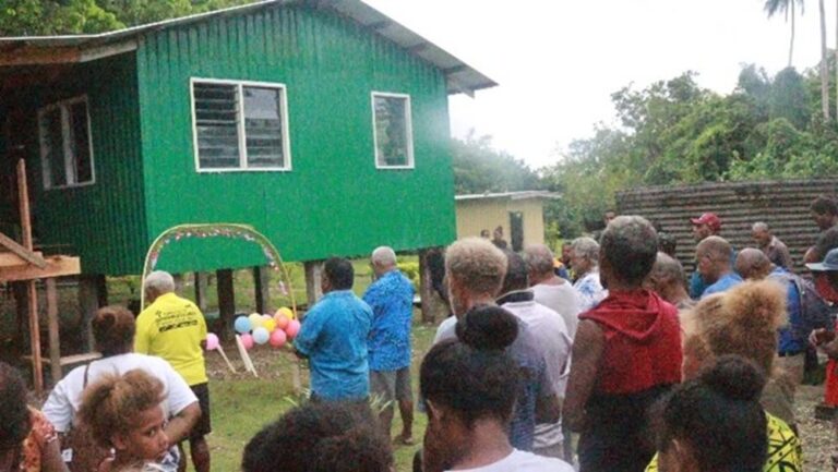
BY JOHN HOUANIHAU
The Solomon Island Meteorology has cancelled the strong wind warning for the country at 7am today morning Saturday 12 February 2022.
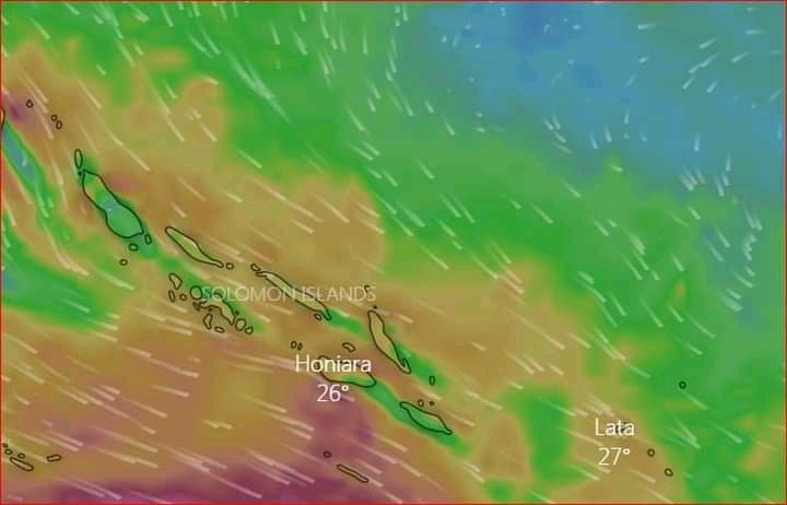
However Weather forecast officer Eddie Maru said the heavy rain warning is still current for most provinces except Renbel province.
Associate cloud and thunderstorm are expected for these provinces according to their official Facebook group.

“This is due to a general westerly wind that flows over the country with a trough that lies south of the country,” the SI MET stated in their weather update.
Ever wondered why the weather we get in our area typically comes out of the west?
This is because of our prevailing wind.
The Westerlies are responsible for the prevailing winds all across the mid-latitudes across the globe according to Historyforkids.
The earth’s rotation causes atmospheric circulations to break down into three different areas on each side of the equator.
Each individual area is known as a circulation cell having their own predominate area within a given latitude, north or south of the equator.
In general, between the equator and 30 degrees north or south latitude, you are within the Hadley cell and experience The Trade winds which blow from the east and converge towards the equator.
Thus, if you’re north of the equator they’re called the Northeast Trade Winds, or if you’re south, the Southeast Trade Winds. (They blow from the northeast or southeast)
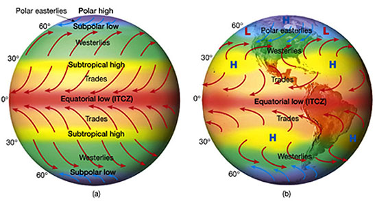
Between 30 and 60 degrees north or south latitude, you are within the Ferrel cell, and within the mid-latitudes. These winds, as said earlier, blow from the west; The Westerlies.
Westerlies are formed due to high-pressure systems within the mid-latitudes when hot air near the equator rises and replaces by cold air.
The hot air soon becomes cold air as it enters the atmosphere because sinking cold air pushes it up, however, other things like mountain slopes can also cause hot air to rises.
These air current of hot air rising and colliding with cold air is what creates thunderstorms.
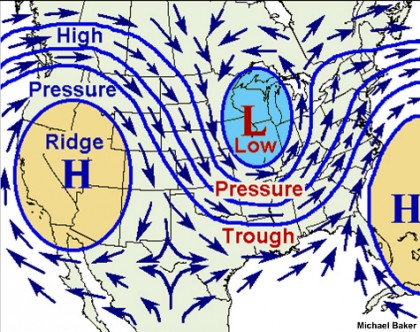
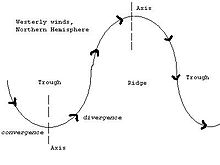
A trough is a lengthened area of lower air pressure and since pressure is closely linked to wind, there are often changes in wind direction across a trough.
Troughs have a direction relative to the poles which is rarely North-South, according to Historyforkids.org.
A trough will usually begin with a positive tilt as cold air moves toward the Equator – ‘National Science Foundation’.
The positive tilt is the building phase of the trough and the negative tilt is the dissipation of its energy it reports.
Therefore, the clouds and precipitation will develop in the positive tilt and fine weather will be in the negative phase.
In the Southern Hemisphere where Oceania is geographically located and Solomon is, the positive tilt will be southeast to northwest and the negative one southwest to northeast.
For a trough in the westerlies, the region just west of the trough is an area of convergent winds and sinking air, and hence high pressure (fine) while the region just east of the trough is an area of fast, divergent winds and low pressure.