THE Solomon Islands Meteorological Services is simplifying the technical language used in weather forecasts and warnings in collaboration with NGOs to help local communities prepare for disaster events.
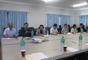
A new Tropical Cyclone Tracking Map, using a simple coordinate grid, was introduced to community workers this week in a two-day long dialogue in Honiara.
Director of the Meteorological Services, David Hiba Hiriasia says the simplified plotting system was made in response to ongoing feedbacks by the public especially when reporting the locations of tropical cyclones using longitude and latitude coordinates.
“Most of our people live in rural areas where literacy is always a challenge and to make matters worse, a lot of these communities are very vulnerable to natural disasters such as tropical cyclones,” the Director said following the successful workshop.
“Using simple methods such as this tropical cyclone tracking map to inform them of the associated risks will definitely assist their preparation and response initiatives.”

The two-day workshop with the Meteorological Services is supported by the Australian Government through the Australian Humanitarian Partnership (AHP) Disaster READY Program in the Pacific.
The Meteorological Services is working with the AHP partners to help deliver the new mapping system to their communities across the country. AHP partners engaged in the dialogue include: CANDO partners, Live & Learn/Caritas Australia, Oxfam in the Pacific, People with Disability Solomon Islands, Plan International, Save The Children Solomon Islands, Solomon Islands Church Association, United Church of Solomon Islands and World Vision Solomon Islands.
The AHP Disaster READY partners currently work with over 200 communities, schools, and churches across the Solomon Islands. They were inducted in a brief training of the new map tracker.
The two-day workshop also used the opportunity to get feedbacks from participants on a simplified pidgin version of weather warning messages that is still in review.

Participant Charles Oloka, Disaster Risk Reduction Portfolio Manager for World Vision Solomon Islands, says the new tracking map is very simplified and he believes that the communities that he works with will find it easy to understand.
“Also, communities will find it easy to link their preparedness plans to possible impacts of cyclones and will enable them to prepare well ahead of cyclones before it strikes in one or two days,” he said. World Vision’s AHP Disaster READY program works across eight communities in Makira.
Rolling out of the new tracking map to the provinces may start as soon as November.
Oxfam’s Humanitarian Coordinator, Nicholas Suava applauded the positive response of the meteorological services and their keen efforts to work with the NGO sector.

“Oxfam and the AHP Disaster READY agencies acknowledge and recognise the importance of the Solomon Islands Meteorology Services, NDMO and the national Government in supporting localisation and progressing in achieving the ideals of integrated disaster risk management and Climate Change adaptation in the Solomon Islands,” Nicholas acknowledged.
“For example, the ongoing partnership and support from the meteorological services in developing very simple and accessible early warning products, and their socialisation to AHP Disaster READY Partners, humanitarian agencies and community-based groups, is key in ensuring that communities are in front of Tropical Cyclone Season preparation and contributes to improved disaster preparedness and response in the most vulnerable communities.”

He said Oxfam, as a leading agency of AHP programs in the Solomon Islands, is committed and support localisation and institutional strengthening; meaningful partnership, effective engagement, building capacity and leadership capabilities for humanitarian sector.
News Source: Solomon Islands Meteorological Services Oxfam in the Pacific – Joint Media Release


