
The Solomon Islands Government in partnership with the Wildlife Conservation Society (WCS) has reaffirmed its commitment to sustainable ocean management with the launch of the new ‘Strengthening Marine Spatial Planning and Ocean Governance in Solomon Islands’ project on 5 November 2026.
Led by the Ministry of Environment, Climate Change, Disaster Management and Meteorology (MECDM) in collaboration with the Ministry of Foreign Affairs and External Trade (MFAET), the Ministry of Fisheries and Marine Resources (MFMR), the other Ocean12 Technical Working Group members and other relevant partners, the initiative aims to strengthen national capacity to lead and coordinate Marine
Spatial Planning (MSP) process, improve ocean governance, and enhance the sustainable management and protection of Solomon Islands' marine and coastal resources for current and future generations.
In delivering her opening remarks, Agnetha Vave-Karamui (Deputy Secretary Technical) of Ministry of Environment, Climate Change, Disaster Management and Meteorology (MECDM) highlighted that ‘the Solomon Islands Government has a long-standing commitment to improving ocean governance since the first National Ocean Summit held in Honiara in 2015.’
Over the past decade, Solomon Islands has continued to strengthen national, regional and global engagement on ocean management, including participation in the previous United Nations Ocean Conferences.
She further emphasised that “the ocean is central to the identity, culture, livelihoods and economy of Solomon Islands, providing food security, fisheries resources, transportation, tourism opportunities and other benefits that sustain communities across the country.”
“However, increasing pressures from population growth, coastal development, pollution, competing ocean uses, overexploitation of marine resources and climate change, demands stronger and more integrated ocean governance.”
“Additional challenges include institutional capacity gaps, enforcement needs, limited financing and the need for improved information sharing across community, provincial and national levels, that needs to be strengthened to support efforts by
Government to properly govern and benefit for its ocean.” “On behalf of the Ministry and the Solomon Islands Government, we acknowledge the support of our partners who continue to contribute to the country’s MSP journey and other organisations supporting seascapes, conservation and marine protected areas network too.”
MSP is recognised as an important tool for balancing environmental protection, economic development and community wellbeing by guiding how marine and coastal areas are used and managed.
“This project will improve the information the government uses to make marine planning decisions by sourcing, and where possible, updating key data and bringing it together in a national MSP database. It will also develop a roadmap for formally recognising and implementing the plan and help government agencies build the capacity to lead the process. Together, these steps will help Solomon Islands continue to advance its national Marine Spatial Planning work” said Dr Alec Hughes, Country Director, WCS Solomon Islands.
To bring context and to update the stakeholders, Mr. Brian Akwasia, Senior Desk Officer of the Ocean and Climate Change Desk within the Ministry of Foreign Affairs and External Trade (MFAET), also delivered a presentation on maritime boundaries, noting that any ocean planning will have to consider the different Solomon Islands’ maritime boundaries.
He stated that “the Solomon Islands shared maritime boundaries with five countries; Australia, Vanuatu, Fiji, France (New Caledonia) and Papua New Guinea. Signed maritime boundary treaties were already established with Australia, Vanuatu, Fiji and France (New Caledonia). The only remaining maritime boundary treaty is with Papua New Guinea, and the treaty is currently with the Attorney General's Chambers for legal review before signing.”
Mr. Akwasia further noted that, “the Solomon Islands is making good progress on its submission to the Commission on the Limits of the Continental Shelf (CLCS).
However, submissions relating to territorial sea boundaries remain an area requiring further development, and the Government is currently working with other partners like the Pacific Community (SPC) to strengthen this aspect of the process.”
“Maritime boundary treaties are crucial in marine spatial planning as they provide a legal framework for defining the rights and responsibilities of coastal states over maritime areas.” With funding support from the Blue Nature Alliance, the Wildlife Conservation Society (WCS) is committed through this project to support the vision of the Solomon Islands National Ocean Policy 2018, which calls for a “a healthy, secure, clean and productive ocean which benefits the people of Solomon Islands and beyond.”
The inception workshop concluded with commitments to implement the workplan in collaboration with all relevant stakeholders and in particular work with the Ocean12 and its key agencies to deliver its activities.
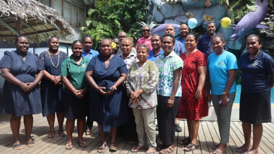
The inception workshop was attended by representatives from Solomon Islands Government ministries, Solomon Islands National University, Solomon Islands Maritime Authority, Non-Governmental Organisations and other existing marine related projects practitioners and experts.
Source: Ministry of Environment Climate Change & Disaster Management